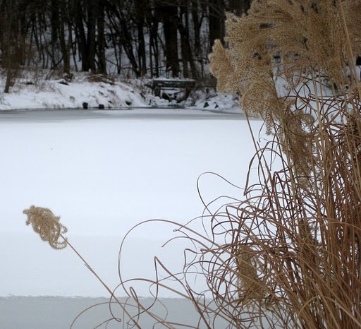
In Staten Island's Bluebelt, you will find the "Heart of Southeast Annadale". In 1972, the City of New York acquired 26 acres in this area. From the early 1960s, citizens had been concerned about this land and its environs, which had
been a paradise for abandoned vehicles. These Staten Islanders tried, for over three decades, to preserve the land. Over the years, as residents began to protect more and more of the surrounding area, more land was obtained by New York City. By 2001, the City had acquired well over 200 acres of land. Today, this land is between Arbutus Avenue and Barclay Avenue to the left and right, and Amboy Road and Hylan Boulevard above and below. It is known as Blue Heron Park.

The entrance to Blue Heron Park lies on Poillon Avenue, a…

4065 Views, 0 Comments

Bunker Ponds Park consists of approximately thirty-two acres of natural habitat. It is located in the neighborhood of Huguenot, across from Intermediate School 7. The park is bordered by the streets of Hylan Boulevard, Huguenot sign1_400Avenue, Arbutus Avenue, and Chester Avenue, close to the Raritan Bay waterfront.

In 1896, William T. Davis and Charles W. Leng studied the area of the park for a map. On the map they referred to the area as Bunker Hill. While studying the area, they found many artifacts, such as arrowheads and spear points which determined that the area used to be part of a Lenape Indian settlement. In the late 20th century, the local community wanted to preserve the natural woodlands of this area and keep it free of development. After the local…

1990 Views, 0 Comments

Staten Island's history has much to do with the history of France.  In 1685, King Louis XIV revoked the Edict of Nantes, which had, until then, given Protestants basic civil rights amongst their fellow citizens.  Once this edict was revoked, many of these people, Huguenots as they were called, fled to New Netherland.  Here, many resided on what is now Staten Island.  By the early eighteenth century, one of these settlers was a James Sigin, who resided here with his family.  His descendants were to become some of the most prominent Staten Islanders of their time.

By the end oflemoncreek1_400 the century, James Sigin's grandson, James Segoin, purchased a vast amount of land by the waterfront, which had a creek that ran through it.  This Segoin's grandson, Joseph…

3203 Views, 0 Comments

Joel Wolfe, a native of Richmond, Virginia, moved to Staten Island during the early part of the nineteenth century, when Staten Island was also known as Richmond. For about twenty years, he spent his days dealing with the importation of gin and brandy from Holland and France.  Wolfe retired in 1848, which is probably around the time that he removed to Manhattan.  While he resided in Manhattan, he still owned the enormous farm on Staten Island wolf1_400and allowed his servants to live there while they took care of the residence.

In 1857, Wolfe sold a parcel of his land to the State of New York who, by fall of that year, had a Quarantine hospital built on the site. The Quarantine hospital was used for immigrants coming to Staten Island who had acquired yellow…

4377 Views, 0 Comments

parksign_400
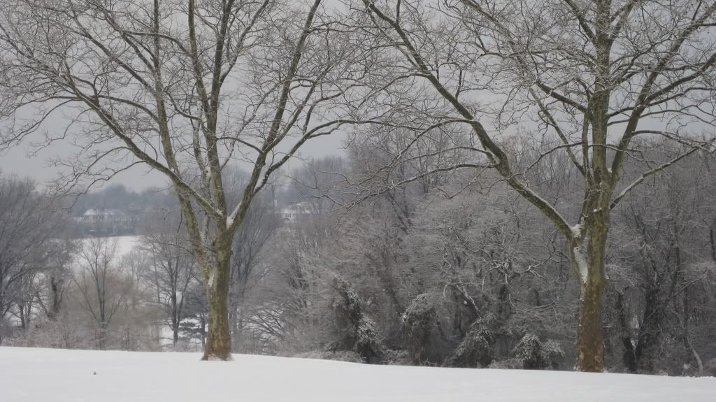
Bloomingdale Park is located on the South Shore of Staten Island. The park is mainly bordered by Lenevar Avenue, Drumgoole Road West, Ramona Avenue, and Bloomingdale Road. The park is also bisected by Maguire Avenue with a pathway connecting the two ends of the street. In the 1960s, the New York City Department of Parks and Recreation obtained the 138 acres of land to protect the area from development. Up until 2003, the park was comprised of only natural woodlands.

In 2003, the New York City Department of Parks and Recreation started to renovate approximately 15-acres of the park east of Maguire Ave. They added three sports fields, two basketball courts, a playground area, a comfort station, a bocce ball court, new walking and bike paths, and a dog…

6553 Views, 0 Comments

Crescent Beach Park is located in Staten Island's neighborhood of Great Kills. The park is mostly beach area but does contain a natural woodland area and facilities such as a playground, and an off-leash dog area. Crescent Beach Park is located below Tennyson Drive. It is between the streets of Wiman Avenue and Hales Avenue.


Crescent Beach Park gets its name from the crescent-shaped sandbar that appears at low tide off the beach by Wiman Avenue. In 1995, the Department of General Services assigned approximately 27 acres of this land to the New York City Department of Parks and Recreation. By 1999 the New York City Department of Parks and Recreation obtained all the land that is part of Crescent Beach Park today. They received the other parcel,…

2615 Views, 0 Comments

Allison Pond Park is a nine-acre piece of land that was named in honor of George William Allison. The park encompasses Allison Pond, as well as a brook that runs throughout the park. Allison Pond Park is in the neighborhood of Randall Manor and is bordered by Prospect Avenue, North Randall Avenue, and Brentwood Avenue.  The New York CWinter on Allison Pond, Randall Manority Department of Parks and Recreation acquired this land in 1943, after having been transferred from the City of New York. The park is locateded in the Randall Manor neighborhood on Staten Island's North Shore.


Allison Pond Park was originally part of Sailors' Snug Harbor. Sailors' Snug Harbor was formed through Captain Robert Richard Randall's will in 1801. In his will, Robert distributed his estate to go to members…

4494 Views, 0 Comments

Barrett Triangle is a small triangular island bordered by Richmond Terrace, Bay Street, and Borough Place in the St. George neighborhood. It is home to the Major Clarence T. Barrett Memorial, along with some benches and a drinking fountain, which is no longer usable due to the relocation of the memorial.

 The Barrett family was one of the most prominent families on Staten Island. Major Barrett studied landscape architecture until the Civil War began when he enlisted for voluntary military duty. He worked his way up the ranks and became Major after the Union siege of Mobile, Alabama. He was also involved in the battle at Richmond, Virginia, which marked the end of the War. After the War, he returned to Staten Island to continue his work in landscape…

2686 Views, 0 Comments

We have written about this house a few times now, but it seems nobody has grasped just how wonderful it is. A few months ago, we informed you of a price reduction on 44 Comfort Court, making is $639,000. It must not have been correctly updated to the website, though, since nobody could see how much of a bargain that was. Well now, the price has been reduced to $599,000. If there's anything better than a bargain, this is it.

You've heard the story: it's a Side-Hall Colonial in the neighborhood of Huguenot. Perhaps we didn't emphasize the grandness of this house, though. 44 Comfort Court is located on a private cul-de-sac, just off of Amboy Road.  The location of the house is possibly as wonderful as the house, itself.  You're right by a number of places…

2178 Views, 0 Comments

Many centuries ago, it was very difficult to show your faith in a different religion, as the prominent religion was Roman Catholicism. Throughout Europe it was especially so, and in France there were many Wars of Religion which LaTourette Golf Course in Winterbroke out. These wars began on August 23, 1572, a day which later came to be known as the St. Bartholomew's Day massacre. On this day, Roman Catholic leaders had 3,000 men, women and children slaughtered in just three days for the sole fact that they were Protestants. The wars lasted until the end of the century, at which point Henry IV, a Huguenot himself, issued the Edict of Nantes, a law which granted Huguenots civil rights. On May 14, 1610, Henry IV was assassinated and the Protestants again feared for their lives.

By 1643,…

6047 Views, 1 Comments